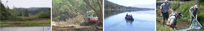
Watershed Science & Climate Change

Changes to the input of water, sediment and wood can upset a river system's natural balance and result in changes to the watershed and its dependent ecosystems. The WPN Team applies remote sensing, field investigations and modeling to determine both past and current watershed disturbances and changes to watershed processes and aquatic and riparian habitats. This approach addresses the various interrelationships between the land uses and stream channel conditions, and allows for a holistic approach to habitat improvement at the watershed scale rather than a “band-aid” fix at a particular site. The WPN team specializes in the following services:
  • Sediment source investigations
  • Sediment input and transport modeling (SEDMODL, WARSEM, WEPP, RUSLE, N-SPECT, HEC-RAS)
  • Watershed runoff modeling (DHSVM, HEC-HMS, TR-20/TR-55)
  • Road maintenance and abandonment plans
  • Channel erosion, stability and migration analysis
  • Large woody debris input and transport
  • Aquatic and riparian habitat evaluations
  • Sediment transport and deposition

Example Methodologies:

OWEB Watershed Assessment Manual (click on title to expand)

WPN designed the Watershed Assessment Manual for use by Oregon Watershed Councils to provide: 1) an educational tool to help council members understand watershed processes, 2) instructions on compiling watershed “baseline” information, and 3) an evaluation of watershed conditions to identify appropriate watershed restoration projects. The methods include instructions for aquatic sampling and analysis, evaluations of land use effects on temperature, sediment, and other fish habitat characteristics.
Click here to see the OWEB Watershed Assessment Manual
Contact Steve Bauer for more information about this project

Washington DNR Road & Sediment Model Update

Kathy Dubé of WPN developed and revised the Washington State Road Surface Erosion Model (WARSEM) that is used in watershed assessments, and as a tool to analyze and monitor the effects of Road Monitoring and Assessment Plans (RMAPs) in forested lands. Kathy Dubé developed a database modeling application, a users manual and application guidelines. Field tests determined model sensitivity to input variables. The model compares the effectiveness of different potential road improvements on reducing sediment inputs to streams.
Click here for more information about the model
Contact Kathy Dube for more information about this project

Watershed Assessment Examples:

Crooked River Environmental Flows Assessment


WPN was retained by The Nature Conservancy and the Deschutes River Conservancy to conduct an environmental flows assessment of the lower Crooked River from Bowman Dam to Lake Billy Chinook. The project team compiled and summarized scientific information on the relationship between streamflow and key ecological and biological processes. The WPN team also conducted a hydrologic conditions assessment of two flow scenarios, and developed hypothetical flow-ecology relationships for key geomorphic processes, salmonid fish species, water quality, and floodplain and riparian processes and functions. Potential effects of climate change in the Crooked River Basin were also analyzed.
Contact Joanne Richter for more information about this project

West Fork Hood River Riparian Management Action Plan


WPN conducted a long-term large wood debris (LWD) recruitment study for the Confederated Tribes of the Warm Springs Reservation for a watershed on the north slope of Mount Hood, Oregon. This pilot project provided an integrated riparian management program that focuses on the sources and limitations of ecosystem services (LWD recruitment and stream shading) through a 100-year time period. Forest structure, composition and large tree mortality were mapped at ultra fine-scales (individual tree boles) using LiDAR and ground truth analysis. Action plan areas were identified to prescribe site-specific treatments for capturing projected tree mortality to use for in-stream salmon habitat enhancement projects.
Contact Chris Heider for more information about this project

Forest Roads Effectiveness Monitoring Phase 1 & 2

WPN assisted Washington Department of Natural Resources (WDNR) and CMER (Cooperative Monitoring Evaluation, and Research) in a long-term monitoring program to determine the effectiveness of Washington’s road-related forest practice rules. WPN geologists prepared field and quality assurance protocols for road erosion monitoring, supervised monitoring efforts and summarized final data. The road condition data were used to model erosion and sediment contribution to streams and wetlands.
Contact Kathy Dube for more information about this project

Granite Creek Watershed Assessmentand Action Plan

WPN members completed a watershed assessment and action plan for bull trout and cutthroat trout restoration opportunities in a ~65,000 acre watershed in NE Washington/ NW Idaho. Limiting factors to native fish populations were assessed, habitat conditions evaluated (connectivity, riparian condition, hydrologic regime, sediment supply, and thermal regime), and a rating system developed. The restoration strategy action plan addresses treatment of fish passage barriers, road sediment sources, LWD enhancement, and riparian management treatments.
Contact Steve Bauer for more information about this project

Conger Wildland Urban Interface Timber Sale & Fire/Fuels Reduction

WPN analyzed an ecologically diverse 5,700-acre timber sale/ fuels reduction project within the wildland-urban interface of Forest Service lands in N.E. Washington. WPN assessed the current and potential natural plant communities, and modeled fire behavior at both local and landscape scales, with the goal to restore the historic and natural range of variability in forest composition, structure and fire regimes.
Contact Chris Heider for more information about this project

North Fork Coeur d’Alene River Watershed Analysis

WPN completed a sediment source investigation, hydrologic assessment, and stream channel assessment of the watershed to support a sediment TMDL Implementation Plan for the North Fork system. The watershed assessment focused on identifying and quantifying sediment sources and impacts related to the condition of 303(d) listed impaired streams within the North Fork subbasin. The analysis summarized watershed land use history; summarized fish distribution and habitat; refined sediment sources and sediment movement; and evaluated hydrologic impacts from land management using Distributed Hydrology Soil Vegetation Model (DHSVM).
Click here to see some of the final products from the North Fork Coeur d'Alene River Watershed Analysis
Contact Kathy Dube for more information about this project

Planning Examples:

Klickitat Subbasin Planning

WPN completed a watershed assessment and watershed action plan for the Klickitat River watershed that addressed water quantity, water quality, instream flows, and fish habitat in the basin. The Level 1 Assessment synthesized existing information regarding water rights, water use, basin fish populations and fish habitat, topography, soils, geologic setting, hydrogeology, climate, and land cover for the entire watershed. Phase II data collection included an evaluation of nitrate concentrations in groundwater, an assessment of storage options, collection of additional information to address interaction between aquifers, and an assessment of the attainable stream temperature in one of the subbasins. In Phase III, Domoni Glass led the local stakeholders, including state and local governments, businesses, and landowners, in the development of a basin-wide management plan that addressed future water demand, water quality issues, and fish habitat concerns.
Contact Ed Salminen for more information about this project

City of Bend Stormwater Ordinance

WPN prepared a draft comprehensive stormwater ordinance that included the following components:
  • Clearing, grading, erosion control and construction site pollution prevention;
  • Stormwater management design standards;
  • Post construction stormwater controls; and
  • Illicit discharge controls
Joanne Richter reviewed all relevant city codes, development standards and specifications to determine where improvements in existing regulations were needed. She identified model ordinance language that could be tailored to address the conditions present in the City of Bend.
Contact Joanne Richter for more information about this project

Lower Clackamas Natural Landscape Assessment

WPN provided a landscape level assessment of potential open space lands in Lower Clackamas Basin, Oregon, to identify priorities for acquisition by Portland Metro’s open space program. Areas were scored on a priority evaluation matrix for ecological values, landscape values, and site condition using a rapid bio-assessment approach.
Contact Chris Heider for more information about this project

Guam Statewide Forest Resource Assessment & Resource Strategy (SWARS)

WPN helped to develop the five-year Statewide Forest Resource Assessment and Resource Strategy for the U.S. territory of Guam. The SWARS is a tool for Guam to identify the highest priorities for forest resource management and seek implementation of these strategies with on-island partners. It includes:
  • State-wide Assessment of Forest Resources – provides an analysis of forest conditions and trends on the island and delineates priority rural and urban forest landscape areas.
  • State-wide Forest Resource Strategy – provides long-term strategies for investing state, federal, and other resources to manage priority landscapes identified in the assessment, focusing where federal investment can most effectively stimulate or leverage desired action and engage multiple partners.
Contact Chris Heider for more information about this project

Climate Change Examples:

Mangroves of Western Pacific

WPN worked with the Institute of Pacific Islands Forestry and International Programs (USDA Forest Service) to quantify the impacts of climate-change related sea level rise on mangrove forests in the western Pacific. Work involved quantifying total ecosystem carbon and nutrient pools along a micro-elevational gradient from the upland-mangrove transition to the mud flats/sea grass communities important for the local fishery. Outcomes include modeling sea level rise effects on the ecosystem services provided by mangrove buffer areas (typhoons, carbon storage, food webs/ fisheries, sediment, etc). Presented findings to government, NGO and international agencies in Palau, greater Micronesia and the United States.
Click here to view a poster prepared from this work
Contact Chris Heider for more information about this project

Ecosystem Impacts of Land Use on Climate Change

WPN participated in a highly detailed and large-scale assessment of total ecosystem carbon and nutrient pools (soils, roots, above ground) to quantify the atmospheric and terrestrial impacts of land-use conversion in the Neotropics. Work specifically involved the measurement, mapping and scaling of many different forest types through the cycle of conversion to agriculture and fallow through deforestation and fire events. Outcomes included the fate and transport of terrestrial carbon pools to the atmosphere, the assessment of land-use viability following combustion and conversion, and the minimum considerations/ sensitivities associated with measuring C pools and creating high-value CDM/ REDD projects. Work has been presented to international panels, governments and the scientific community.
Click here to view a poster prepared from this work
Contact Chris Heider for more information about this project